A seismic station is always part of a network of seismic stations, so associated with each station are network and station codes. The network code is a two-character code that identifies the "operator" of the seismic station. The station code identifies the particular site hosting the instruments. Most stations include more than one sensor, but even if only one seismometer is located at the site, generally three-components of ground motion (that we call "channels") are recorded. We identify different sensors at a particular location using "location codes", which are usually two-character codes assigned to each sensor at the station.
Thus to identify and acquire a seismogram requires that you specify the time range of interest and a
- network code
- station code
- location code
- sensor channel
This may seem like a lot of trouble, but request tools often allow you to "wild-card" the codes, which makes it relatively easy to acquire any and all available data.
Before moving onto some details, let me state that permanent networks are those that are established for a relatively long period of time, temporary networks are those deployed for a shorter, fixed period, often as part of a PASSCAL or aftershock monitoring deployment. I'll focus on permanent networks in these notes - examples include IU, US, (networks operated by the USGS).

Stations and Channels
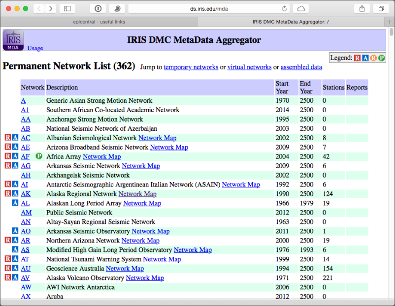
Two places to start browsing to see lists and maps the available seismic stations are the IRIS "mda" meta-data-aggregator (http://ds.iris.edu/mda) and the other is a map of real-time seismic data (http://www.iris.washington.edu/gmap/_REALTIME) (not all the useful data is available in real time).
Near Real-Time Seismic Station Map from IRIS
The image below shows the near-real time seismic stations operating in the northeastern US / southeastern Canada that are available from IRIS.
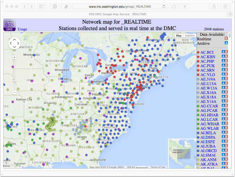
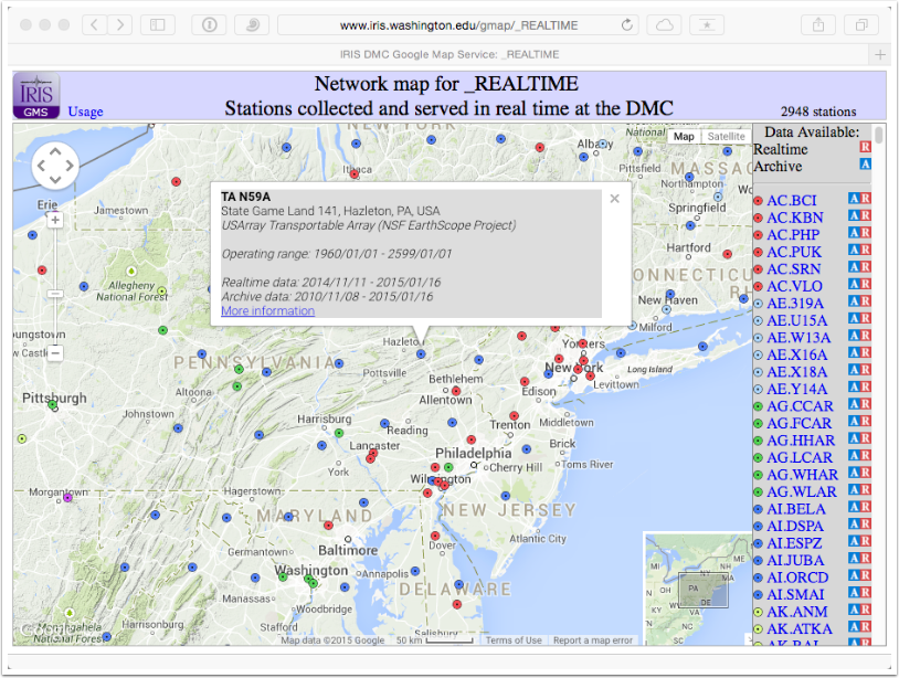
The map is interactive, clicking on a station symbol produces a summary with a link to more detailed information about the sensors operating at that location.
The basic information is the latitude, longitude, and elevation of the site, and the time range during which at least some data have been recorded. The different "instruments" are listed in the table below and links to more detailed information for every "channel" of the "sensor". Generally you can find environmental sensors (pressure, etc.) and ground motion sensors (ground velocity, acceleration, etc.). Seismometers usually have three channels and these are labeled by channel ID's like "BHZ", "BHN", etc.
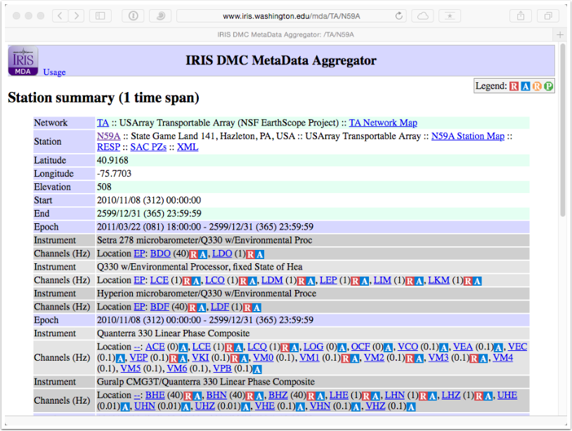
Clicking on a channel ID (link) produces a summary of the information on the channel. The specific location, the orientation of the chanel, the data sampl rate, etc.
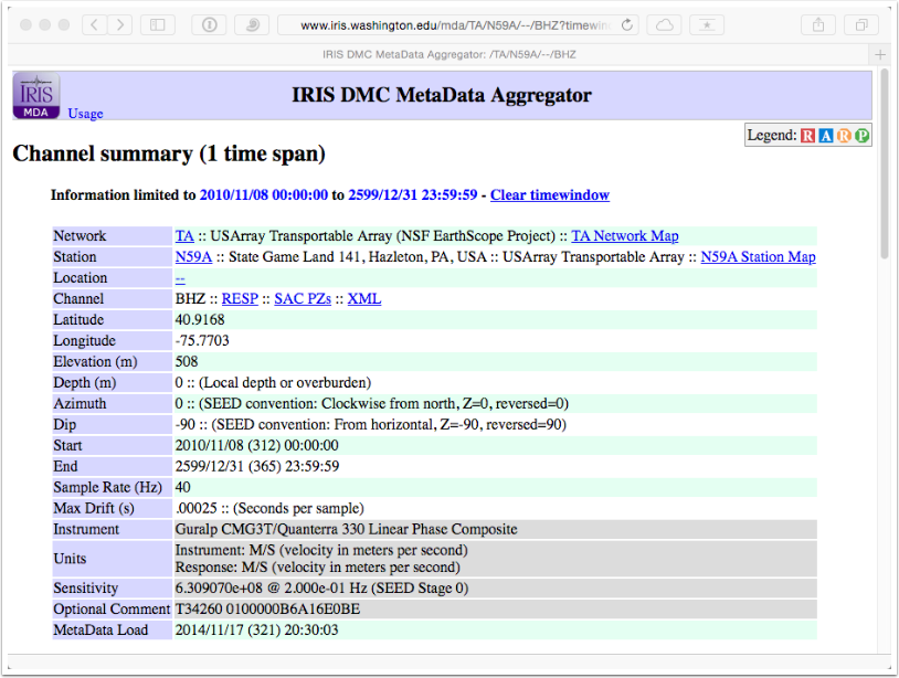
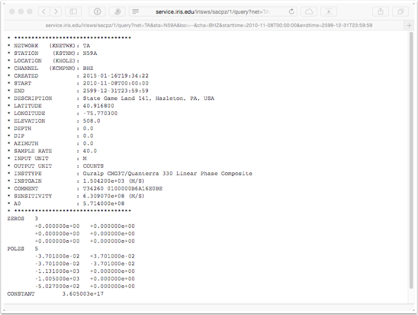
Clicking on the SAC PZs link produces a simple text listing of the instrument response parameters.
Explore
The best thing you can do now is explore the stations that are available, read the descriptions, compile questions about what the various values mean, and discuss them with eachother and with senior students and me. Then find a station that interests you and go look at the data from that station using the time-series web service, which is a fine tool for a quick-check of some data.