For moderate-size earthquakes, perhaps the best place to look for information information on a moderate-size (say, M ≥ 5) earthquake that occurred since 1973 is the US Geological Survey. This is not the only place to look for information, and not always the best information - for example more localized catalogs are available for regions with dense seismic networks run by other countries such as Japan, Italy, China, etc. But for earthquakes in the US and its territories, or a good start on moderate-magnitude global activity, the USGS is a good place to start.

earthquake.usgs.gov
The section title is easy to and worth remembering. The USGS earthquake catalog search tool can be found at
http://earthquake.usgs.gov/earthquakes/search/
Here's a screen shot of the site. Note that the search results are limited to 20,000 events. For specific details on what the particular form values mean, read over the "Help" and the "About ANSS Comprehensive Catalog" pages.
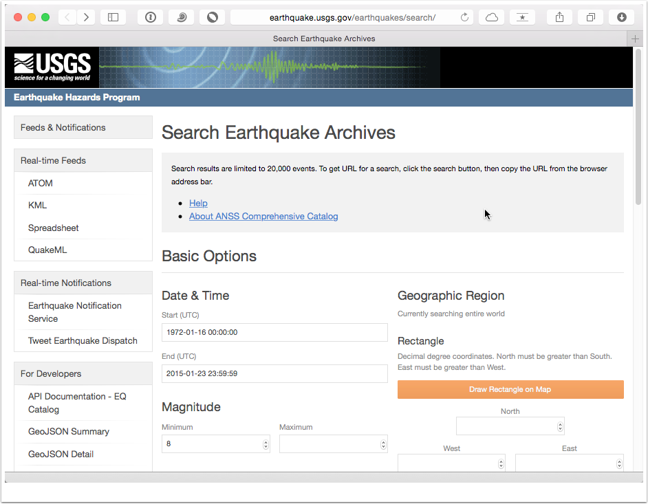
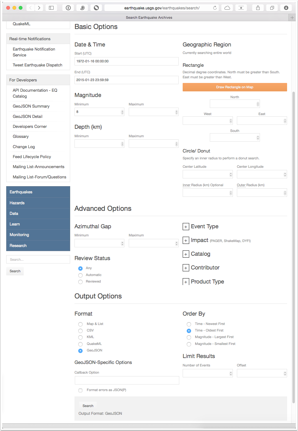
The basic plan for a search is pretty straightforward. Generally, you specific the region using limites on latitude, longitude and depth, a time range, and a magnitude range, although some other adjustments on the type of event, etc, can also be applied. Then you select the output format and click the search button down at the bottom of the form.
UTC
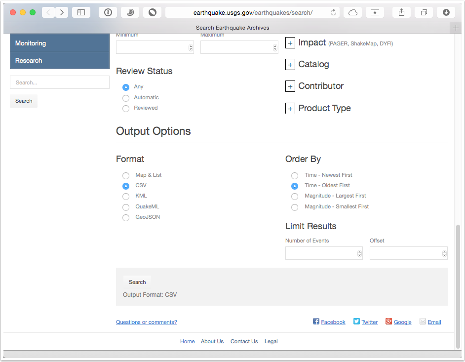
The times that you enter by default are in Universal-Time-Coordinated, UTC, which is the standard time used in scientific applications. I set the start time to 1972-01-16 00:00:00 (before the start of the data in 1973) and the minimum magnitude to 8.0 and conducted a global search by not provided and information in the Geographic Region fields. I also selected a "CSV" output format and ordered the results by oldest event first.
Great Earthquakes Since 1973
The result of that search is a list of the great earthquakes in the catalog since 1973 (we call an earthquake great if the magnitude is eight or greater). The default output format is a list and map, which are useful if you are just browsing the results. You can also request a "kml" file to plot in Google Earth (or other compatible mapping tools).
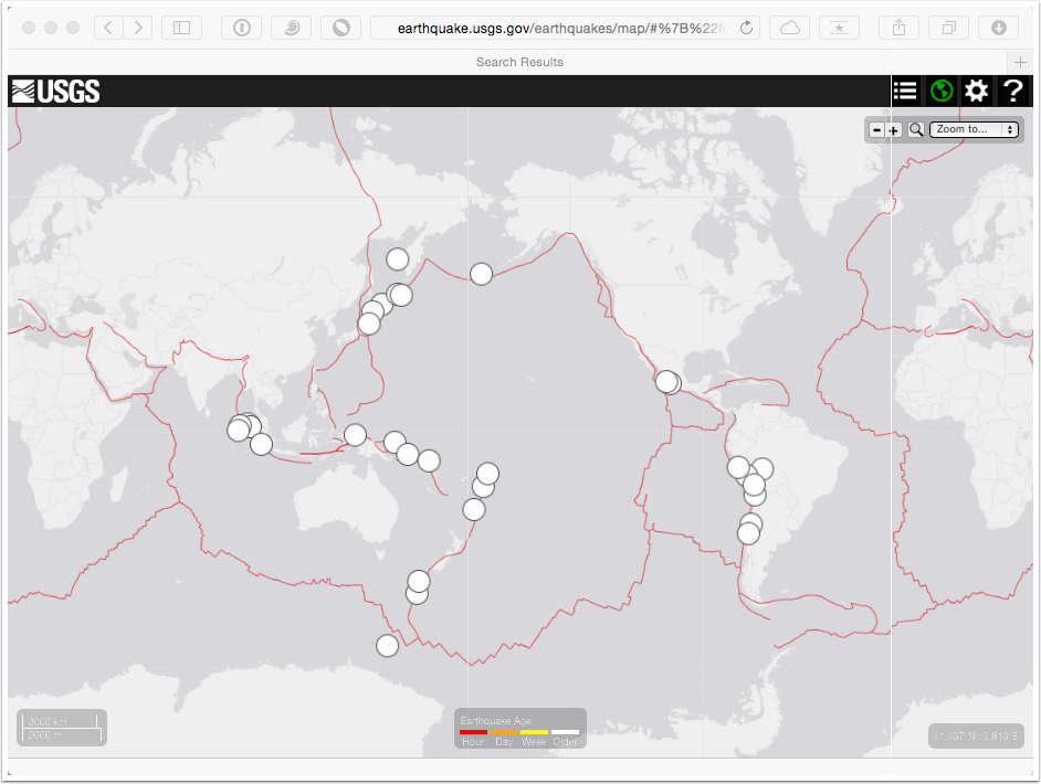
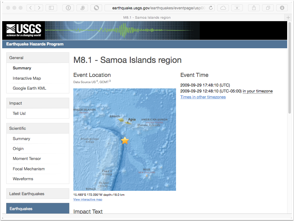
By clicking on the earthquake symbol and then on the link to the event page, you can explore information about these large earthquakes. Knowing something of the history of large earthquakes is an important part of observational seismology.
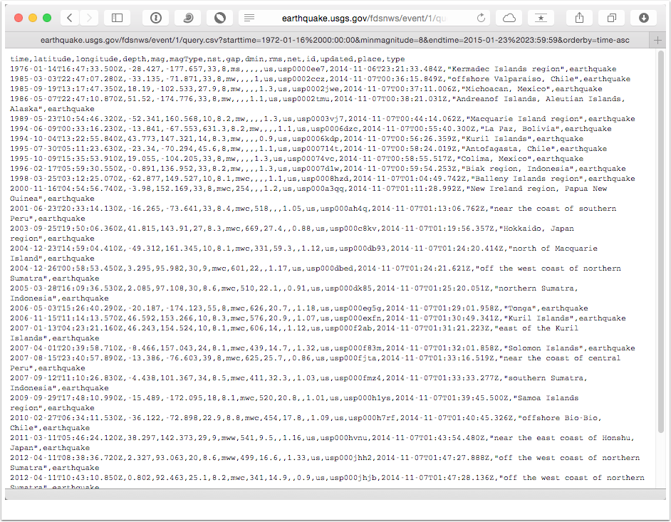
CSV Format
If you want to make you own map or compute something from the search results, you need the data as text. The "CSV" format is relatively convenient because it is easy-to-import into many software packages and can be read relatively simply without much processing. The result is a list of the column headings and 31 earthquakes. Again, see the help to find the definition of the column headings. If something isn't clear, ask me.
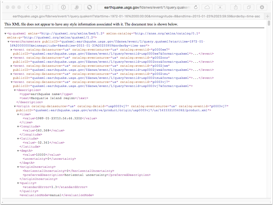
QuakeML (XML) Format
XML is short for Extensible Markup Language and it is a text format, but not so easy to read. QuakeML is format definition for storing earthquake information in XML. The idea is that you plan to process the results with software that can parse the XML format, which can include a tremendous amount of information on the event. The raw QuakeML is very difficult to read, but commonly used browsers (Chrome, Safari, etc.) can format the XML for more easy viewing. Quake ML is verbose, each information item is stored within starting and closing "tags". The "tags" are defined by the QuakeML definition, which has been developed for the purpose of earthquake catalog/database information exchange.
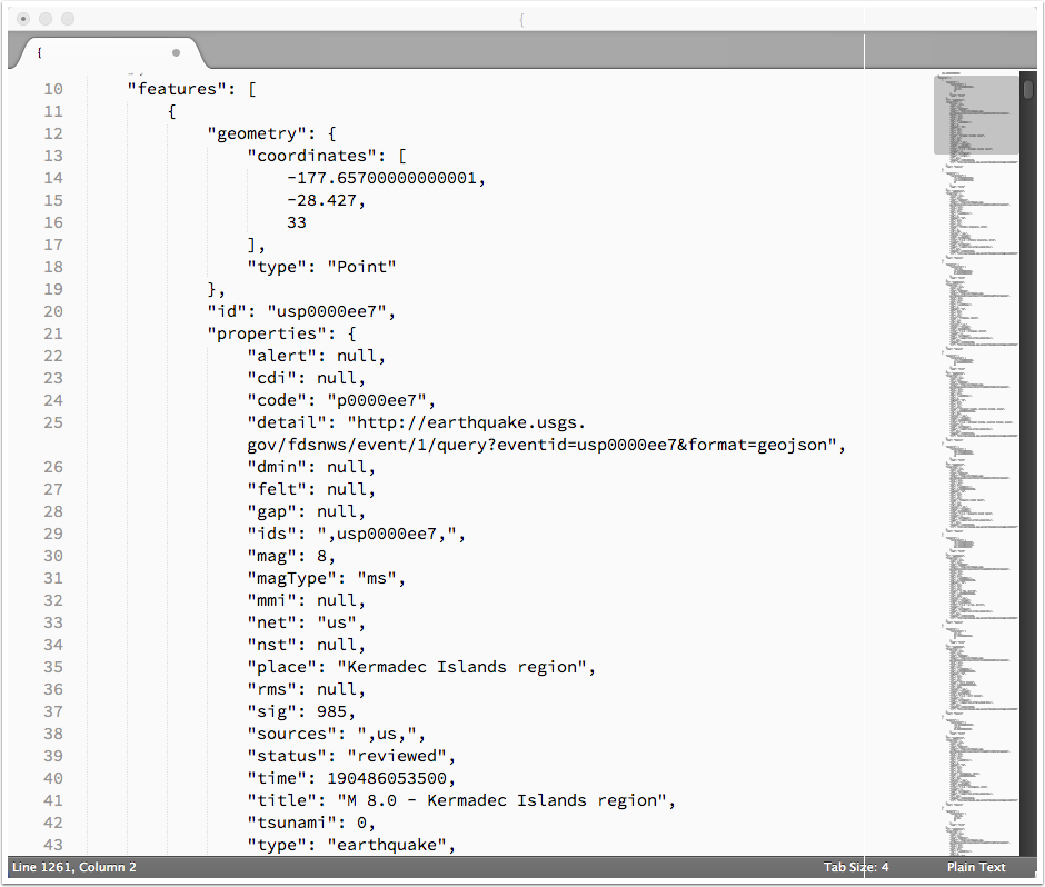
GeoJSON Format
A response to the XML formats that are incredibly verbose and in many cases overkill for simple information exchange, the JSON formats were developed. JSON represents Javascript Serialized Object Format - a way of representing objects of object-oriented programing with simple text dictionaries. JSON formats are easily customizable, and GeoJSON is a customization with geographic items.
The GeoJSON shown below looks even harder to read that the XML, but it's not, it's just that the browser doesn't make it easy to read.
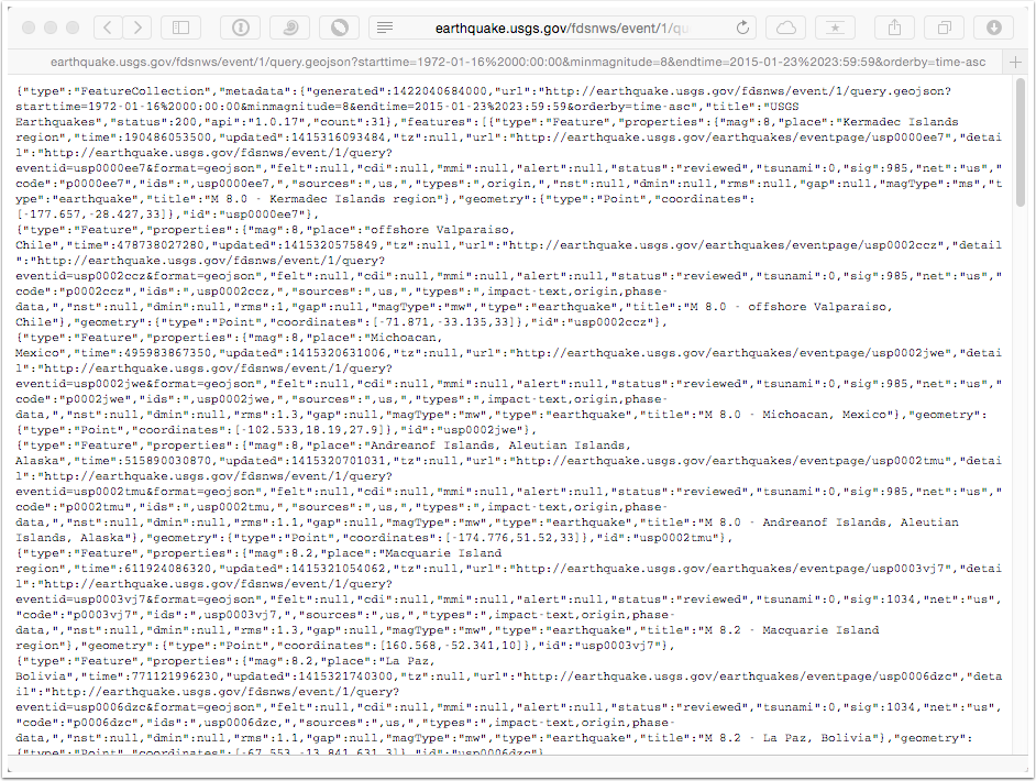
A good editor can re-indent the GeoJSON information. Each item is really a "key" and a "value". With the right software, you just ask for the values using the keys, and it's pretty convenient to parse.
Explore
You should explore the search tool on your own. Perform searches that limit the geographic region, that look for specific magnitude ranges. Examine the results in different formations. Skim the wikipedia pages on XML and JSON.